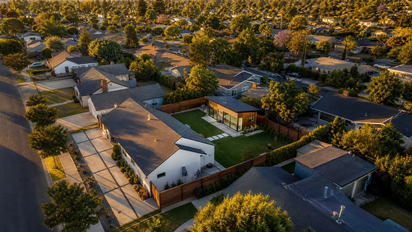
When you submit an accessory dwelling unit application to your municipal building department, the first drawing the plan checker examines is the ADU site plan. Also referred to as a plot plan, this overhead drawing shows your entire property from a bird's-eye perspective. While interior floor plans show where bedrooms and kitchens sit inside the walls, the site plan proves that your new detached building legally fits within your property boundaries, satisfies zoning setbacks, respects public utility easements, and provides mandatory fire department emergency access.
Direct Answer: What Must an ADU Site Plan Include?
A permit-ready adu plot plan must show: exact property line dimensions, the location and footprint of all existing structures (primary house, garage, shed, patio covers), the footprint of the proposed ADU, dimensioned setbacks from all four property lines, the physical distance between existing and proposed buildings, recorded utility easements, points of connection for water, sewer, gas, and electrical lines, surface rainwater drainage flow, and an unobstructed fire department path of travel from the street to the ADU entrance.
What This Site Plan Guide Covers
Site Plan vs. Floor Plan vs. Boundary Survey
Homeowners often confuse these three distinct documents. Each document serves a unique purpose during the permitting and construction process:
1. Boundary Survey
A boundary survey is prepared and stamped exclusively by a state-licensed Professional Land Surveyor (PLS). The surveyor visits your property with precision optical or GPS equipment, locates buried iron pins or property corner monuments, cross-references recorded county deeds and subdivision tract maps, and establishes legal property lines. A survey does not design a new building; it verifies where your land legally starts and stops.
2. Architectural Site Plan (Plot Plan)
An architectural site plan is drafted by an architectural designer (usually Sheet A0.1 or C1.0 in your permit set). It uses boundary dimensions (often taken from public parcel maps or a surveyor's plat) to establish the position of the proposed ADU. It calculates zoning metrics like lot coverage percentages, floor-area ratios (FAR), and building separation. Learn how this fits into your overall permit drawing set in our guide to the ADU building permit process.
3. Interior Floor Plan
An interior floor plan zooms in on the proposed building itself (typically at 1/4-inch = 1-foot scale). It details interior wall partitions, door swings, window egress dimensions, kitchen counters, and bathroom fixtures. A floor plan shows zero property lines and cannot be substituted for a site plan.
| Document Type | Who Prepares It | What It Shows | Legal Authority |
|---|---|---|---|
| Boundary Survey | Licensed Professional Land Surveyor (PLS) | Legal property corners, recorded monuments, easements, encroachments | Legal property boundary proof |
| ADU Site Plan (Plot Plan) | Architectural Designer / Draftsperson | Proposed ADU footprint, setbacks, utilities, fire path, lot coverage | Zoning and building code compliance |
| Architectural Floor Plan | Architectural Designer / Draftsperson | Interior room layouts, dimensions, door swings, window egress, plumbing | Habitability and life-safety compliance |
The 10 Required Elements on a Permit-Ready Site Plan
Municipal building departments (such as the City of Riverside CEDD or local development services in your region) publish strict checklists for site plan review. An incomplete plot plan triggers immediate plan check rejection. Your designer must include these ten essential layers:
1. Title Block and Legal Identification
Every sheet must carry a complete title block with the property owner's name, street address, Assessor Parcel Number (APN), legal subdivision tract and lot number, sheet title (e.g., "Site Plan & Vicinity Map"), scale, drawing date, and revision history.
2. North Arrow and Engineering Scale
The plan must include a clear north arrow (indicating true north or project north) and a designated standard scale. Many jurisdictions also mandate a graphical bar scale so that digital reproductions or photocopies can be scaled accurately even if printed at non-standard sizes.
3. Property Lines and Boundary Dimensions
The perimeter property lines must be drawn with heavy, distinct line weights and labeled with exact foot-and-inch dimensions (matching county parcel maps or recorded survey plats). If your parcel has curved boundaries or cul-de-sac radii, arc lengths and radii must be indicated.
4. Existing Structures and Improvements
Show all existing structures on the parcel: the primary single-family residence, attached or detached garages, accessory sheds, carports, swimming pools, concrete patios, and driveways. Each structure must be labeled with its square footage and roof overhang dimensions.
5. Proposed ADU Footprint and Dimensions
The proposed accessory dwelling unit must be clearly distinguished from existing buildings (using diagonal cross-hatching, bold outlines, or shaded infill). Label the exterior finished dimensions, total proposed square footage, overall building height, and roof ridge elevation.
6. Setback Dimensions
Dimension lines must clearly measure the shortest perpendicular distance from the exterior wall (and eave overhang) of the proposed ADU to the rear property line, interior side property lines, and street frontages. Setbacks must satisfy state and local minimums. In many states, detached ADUs require 4-foot rear and side setbacks. For detailed property line rules, consult our guide on ADU setback requirements.
7. Building Separation
Building codes require an explicit dimension measuring the clear distance between the proposed ADU and the primary home (as well as any detached garages or accessory structures). Most municipal fire and residential codes mandate a minimum separation of 6 to 10 feet. If buildings sit closer than 6 feet, fire-rated exterior wall construction and non-vented eaves are triggered.
8. Recorded Easements and Rights-of-Way
Public utility easements (PUE), drainage channels, power line corridors, and municipal sewer access rights must be shown with dashed lines and labeled with their recorded width. Building any portion of an ADU, foundation footing, or roof eave over a recorded easement is strictly prohibited unless you secure an official written abandonment or encroachment permit from the easement holder.
9. Utility Points of Connection (POC)
Your site plan must map out the route of underground utilities from the ADU to their source:
- Sewer: Show the new 3-inch or 4-inch sewer lateral sloping to the main house sewer cleanout or municipal main.
- Water: Show the supply line connecting to the existing water meter or main house distribution line.
- Electrical: Show the trench path of the electrical conduit running to the primary electrical service panel or new subpanel.
- Gas (if applicable): Show the trench path and shutoff valve location.
10. Fire Department Emergency Access (Path of Travel)
Fire marshals review site plans to ensure firefighters can reach the ADU in an emergency. The drawing must show an unobstructed exterior path of travel (typically minimum 36 inches wide, free of gas meters, air conditioning units, or fence gates narrower than 36 inches) extending from the public street to the primary ADU entrance door. Many fire districts cap this hose-lay distance at 150 feet from the public street or nearest hydrant.
Scale, Orientation, and Sheet Standards
A common mistake among homeowners who attempt to sketch their own plot plan is using arbitrary measurements or drawing without an architectural scale. Building officials require drawings to be mathematically verifiable.
Municipalities typically accept two standard scale formats:
- Civil / Engineering Scales: 1 inch = 10 feet (1:10), 1 inch = 20 feet (1:20), or 1 inch = 30 feet (1:30). Engineering scales are preferred on larger residential parcels (over 10,000 square feet) because they allow the entire lot, street right-of-way, and driveway to fit on a standard sheet.
- Architectural Scales: 1/8 inch = 1 foot (1:96) or 1/4 inch = 1 foot (1:48). Architectural scales are common on smaller, compact urban lots (under 6,000 square feet).
Standard sheet sizes are also mandated by local building departments. Most plan check counters require digital PDF submittals formatted to 24x36-inch (Arch D) sheets, while some smaller jurisdictions permit 11x17-inch (Tabloid) sheets for small single-story conversions. Standard 8.5x11-inch letter paper is almost universally rejected for site plan submittals.
When Does the City Require a Licensed Land Survey?
In many suburban subdivisions with clear tract boundaries and rectangular parcels, an architectural designer can draft a compliant site plan using recorded subdivision maps, county GIS parcel data, and physical on-site tape and laser measurements. However, certain site conditions trigger a mandatory requirement for a licensed Professional Land Surveyor (PLS):
1. Building Within Inches of the Minimum Setback
If your local zoning allows a 4-foot rear setback and your proposed ADU design places the exterior wall exactly 4 feet 0 inches from the fence line, city plan checkers will often demand a certified boundary survey. Fences rarely sit on true legal property lines; fences are frequently offset by several inches or feet. An error of 2 inches could result in your newly poured concrete foundation trespassing into an illegal setback.
2. Missing or Destroyed Property Corner Monuments
If property corner survey markers (iron pins or brass caps set in concrete) cannot be uncovered at your property corners, your designer cannot prove where the property line lies. A surveyor must be hired to perform a boundary retracement.
3. Steep Slopes and Hillside Grading (Topographic Survey)
When the building site slopes more than 10% to 15%, a standard flat plot plan is insufficient. The city will require a topographic survey showing 1-foot or 2-foot elevation contours, existing and proposed spot elevations, cut-and-fill calculations, and swale flow lines prepared by a licensed surveyor or civil engineer.
4. Designated FEMA Flood Zones
If your property sits in a Special Flood Hazard Area (Zone A or AE), the building department will require a FEMA Elevation Certificate signed by a licensed surveyor to certify the natural ground elevation and determine the minimum height of your foundation.
5. Heritage Tree Encroachments
Cities with strict tree preservation ordinances (protecting native oaks, redwoods, or historic sycamores) require site plans to accurately locate tree trunks within 20 feet of construction, showing the exact tree dripline canopy to evaluate root protection zones.
Top 5 Reasons Plan Checkers Reject ADU Site Plans
Understanding where submittals fail saves weeks of plan check delays. Municipal plan check corrections routinely cite these five errors:
- Measuring Setbacks to the Fence Instead of the Property Line: Fences are notoriously inaccurate. Designing an ADU based on an existing wooden fence line is the single most common cause of setback violations.
- Omitting Roof Eave Overhangs: Setback measurements must account for roof overhangs. If a local ordinance prohibits eaves from extending closer than 3 feet to a side property line, designing an eave that projects 18 inches into a 4-foot setback triggers an immediate plan correction.
- Failing to Show Utility Trench Routes: Simply placing the ADU box on the lot without showing where sewer, water, and power connect to the city main or primary home causes a plan check correction.
- Missing Impervious Surface and Lot Coverage Calculations: Many jurisdictions cap total lot coverage (roofed areas) at 40% to 50% or enforce maximum impervious surface ratios. Failing to provide a calculation table showing existing square footages, proposed additions, and total percentages leads to rejection.
- Obstructed Firefighter Path of Travel: Drawing a pathway that passes through a locked gate, navigates narrow 24-inch side yard equipment clearances, or exceeds maximum hose-lay distances forces a redesign.
Frequently Asked Questions
Can I draw my own ADU site plan?
While some building departments technically allow homeowners to draft their own plot plans, DIY sketches are routinely rejected during plan check. A site plan must be drawn to an exact architectural or engineering scale, include verified property line bearings, dimensioned utility laterals, fire access routes, and lot coverage calculations. Working with an experienced architectural designer ensures the site plan integrates cleanly with structural and MEP drawings.
How much does a boundary survey cost for an ADU?
If your city requires a formal boundary survey by a licensed Professional Land Surveyor, costs typically range from an estimated $1,500 to $3,500 for a standard residential lot. On steeply sloped parcels requiring full topographic contour mapping and tree location grids, survey fees can range from an estimated $3,000 to $5,500.
What is the difference between a plot plan and a site plan?
In residential construction, the terms "plot plan" and "site plan" are used interchangeably by building departments. Both refer to the scaled, overhead drawing showing property boundaries, existing structures, proposed additions, setbacks, and utility connections.
Can an ADU be built over a utility easement?
No. Permanent structures, including concrete foundations, wall framing, and roof eaves, cannot encroach into recorded public utility easements (PUE) or municipal drainage easements. Utility providers retain the legal right to excavate their easements to service underground lines. If your desired ADU location overlaps an easement, you must either redesign the footprint or apply for a formal easement vacation through your city council, which is rare and costly.
How far does an ADU have to be from the main house on the site plan?
Most building and fire codes require a minimum clear separation of 6 to 10 feet between detached residential buildings. If an ADU sits closer than 6 feet to the main dwelling, building codes treat the buildings as structurally connected or mandate 1-hour fire-rated exterior wall construction with no unprotected window openings facing the primary structure.
Confirm Your Property Setbacks and Lot Eligibility for Free
Every successful ADU begins with an accurate assessment of where your unit can legally sit. Before paying for physical boundary surveys or spending weeks trying to draft your own plot plan, establish your property's zoning envelope with certainty.
Start with our free ADU feasibility check. We analyze your lot against municipal zoning databases, setback rules, and easement records to verify whether your parcel qualifies for an ADU. We won't even take your money unless your property qualifies.
Once feasibility is confirmed, Build With A Plan provides full permit-ready architectural and engineering drawing sets through the Backyard Wealth Package ($6,000 flat). Our drawing packages include complete code-compliant site plans, dimensioned floor plans, exterior elevations, foundation details, and electrical layouts formatted specifically for your city's submittal portal. Where engineering or professional stamps are required by local building departments, we coordinate review with licensed professionals. We handle city plan check paperwork, manage municipal revisions, and connect you with financing resources and vetted local builders. We guarantee your drawings will be accepted for submission by your city, or we revise them free until they are. And if your property doesn't pass our free feasibility check, you pay nothing.